Why Cape Naturaliste?

Silhouette of a lighthouse on a rocky hill overlooking stylized ocean waves, with a beige sky background.

Landfill and liquid waste have no place inside a national park buffer, just three kilometres from Dunsborough and Yallingup towns and the beaches that support them.

Why did council select Vidler Road?

What alternatives did they review back then or since?

Why expand this facility located next to a national park?
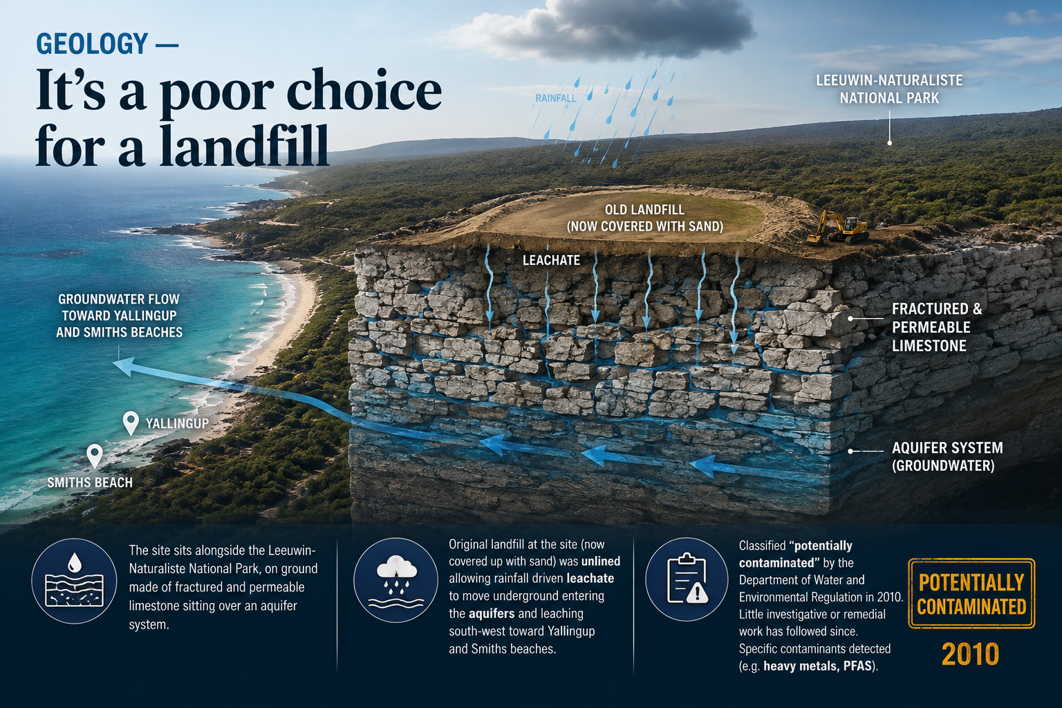
Cross-section illustration of a landfill site next to the coastline, showing groundwater flow and leachate leakage into an aquifer system, with labels indicating old landfill, fractured limestone, and national park nearby. Rainfall is depicted affecting the site, and the groundwater flow is directed toward Yallingup and Smiths Beach.

Geology — It’s a poor choice for a landfill
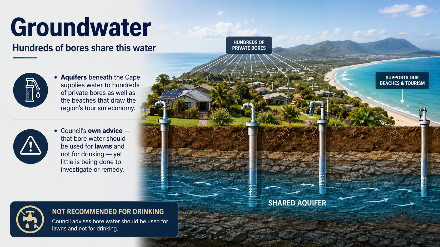
Illustration of groundwater sources and usage. It shows aquifers beneath the coast, private bores, and a shared aquifer. The image emphasizes that groundwater supports beaches and tourism and advises against using bore water for drinking, recommending it only for lawns.

Groundwater — Hundreds of bores share this water
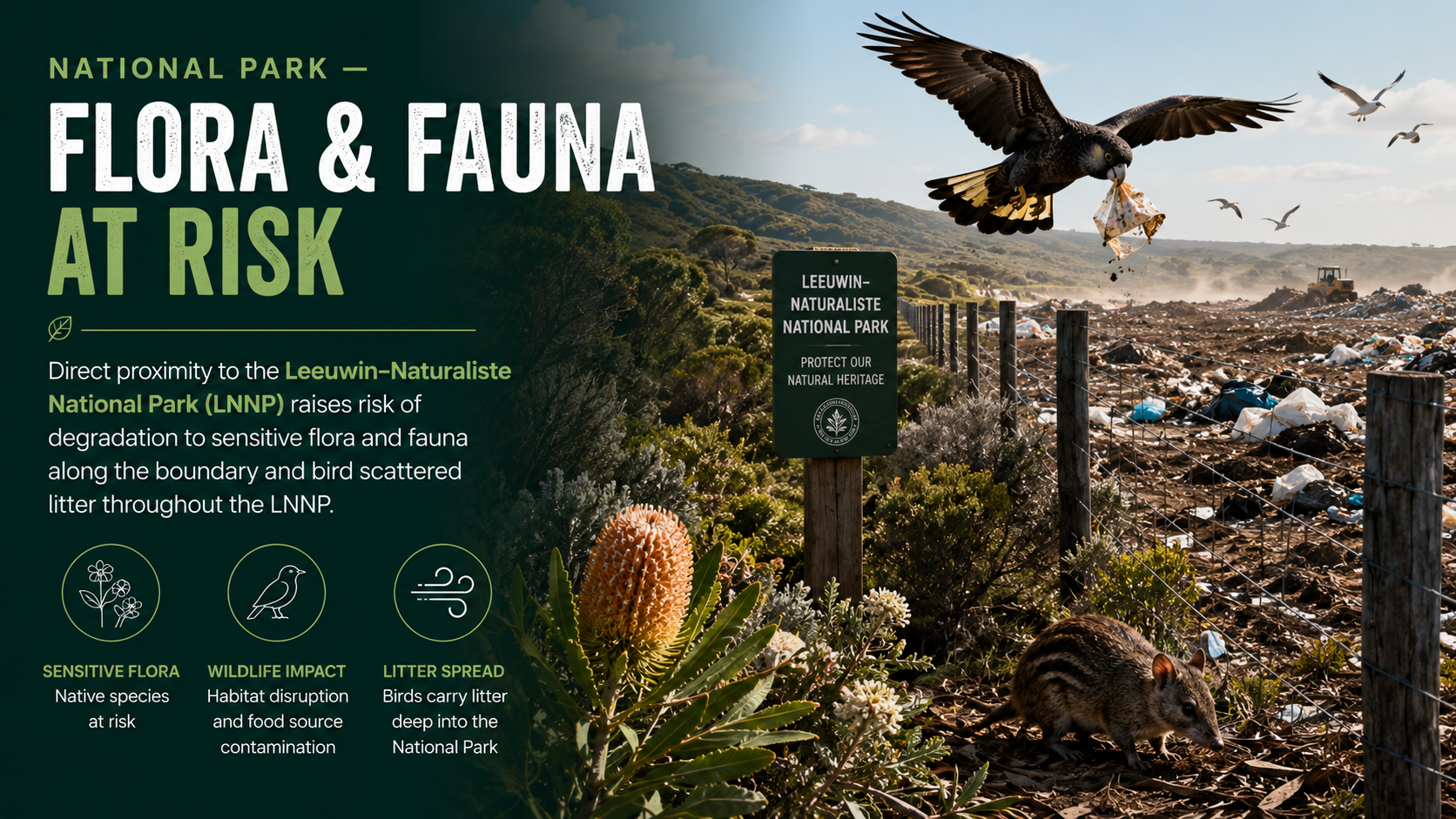
A polluted landfill near Leeuwin-Naturaliste National Park with a bird flying above carrying discarded plastic. A dog is in the foreground near plants, and a sign indicating the park's protection is displayed. The scene highlights environmental risks to sensitive flora and fauna.

National Park — Flora & fauna at risk
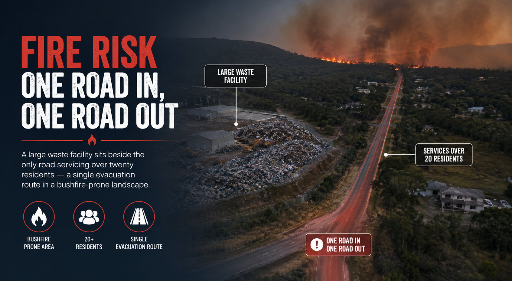
Aerial view of a wildfire on a hillside with smoke billowing, adjacent to a waste facility next to a road. The road is marked as the only evacuation route for over twenty residents, with signs indicating the situation and urging evacuations. The scene highlights the risk of fire threatening a small community.

Fire Risk — One road in, one road out
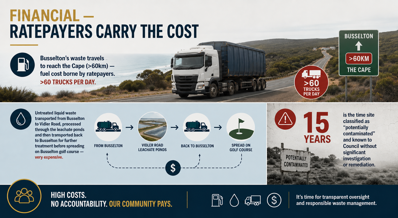
Infographic about the environmental and financial impact of waste transportation in Busselton, featuring a truck on the road, a highway sign indicating more than 60 km to the Cape, and diagrams showing the waste treatment process and contamination timeline.

Financial — Ratepayers carry the cost