
Our Campaign

Council wants to extend and expand the Vidler Road landfill contract for 30+ years — with no long-term waste strategy, and no community consultation.
What Council is proposing…
The Shire of Busselton is seeking a significant expansion of the existing landfill site in Cape Naturaliste, irrespective of:
The expansion provides capacity for 30+ years, yet the current license being due to expire in 2030.
01
The current license being due to expire in 2030.
02
The absence of a long-term waste management strategy for the Shire — which was promised in 2021.
03
No public consultation prior to lodging the expansion plans with DWER.
04
No formal assessment of more appropriate sites.
05
Any determination of the current Vidler Road site’s “possible contamination” classification by DWER.
No formal assessment of more appropriate sites.
02
No public consultation prior to lodging the expansion plans with DWER.
05
The absence of a long-term waste management strategy for the Shire.
04
The Shire of Busselton is seeking a significant expansion of the existing landfill site in Cape Naturaliste, irrespective of:
Any determination of the current Vidler Road site’s “possible contamination” classification by DWER.
03
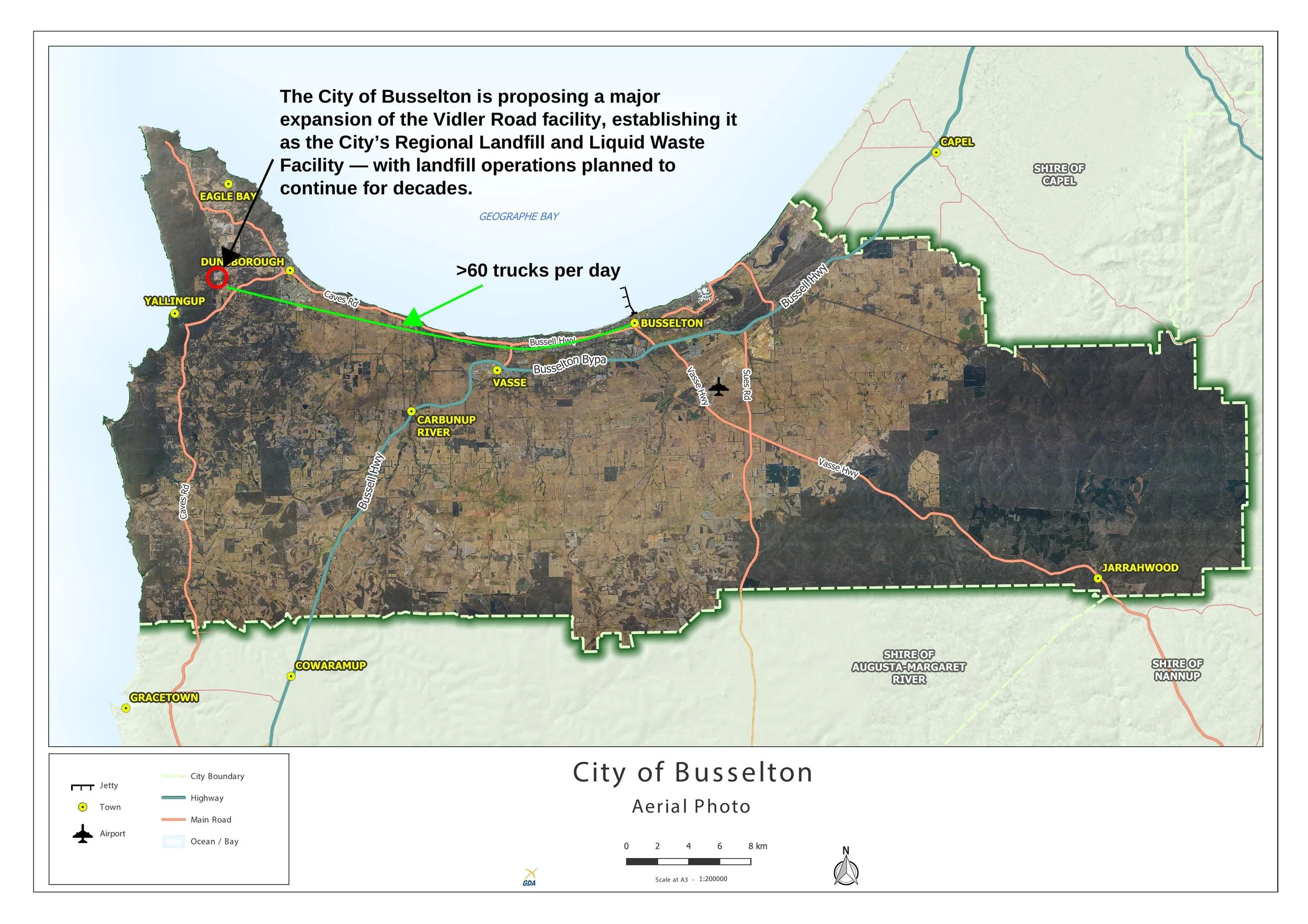
Council has submitted to DWER a major expansion proposal for the Cape Naturaliste landfill — see here for details.
The Site
What we’re asking for…
The Cape Naturaliste Community Association (CNCA) is seeking to achieve the following from the Busselton Council:
01
A withdrawal of the request to DWER for an expansion of the Vidler Road site.
02
The development of a long-term waste management plan.
03
Consideration of alternative sites for the Shires’ landfill and liquid waste.
01
Consideration of alternative sites for the Shires’ landfill and liquid waste.
04
Review of waste to energy solutions.
05
Public consultation prior to the adoption of a new strategy.
A withdrawal of the request to DWER for an expansion of the Vidler Road site.
06
Investigation into the possible contamination at Vidler Road as requested by DWER.
07
Remediation of the full unlined landfill.
02
The development of a long-term waste management plan.
05
04
06
07
Review of waste to energy solutions.
Public consultation prior to the adoption of a new strategy.
03
Remediation of the full unlined landfill.
Investigation into the possible contamination at Vidler Road as requested by DWER.